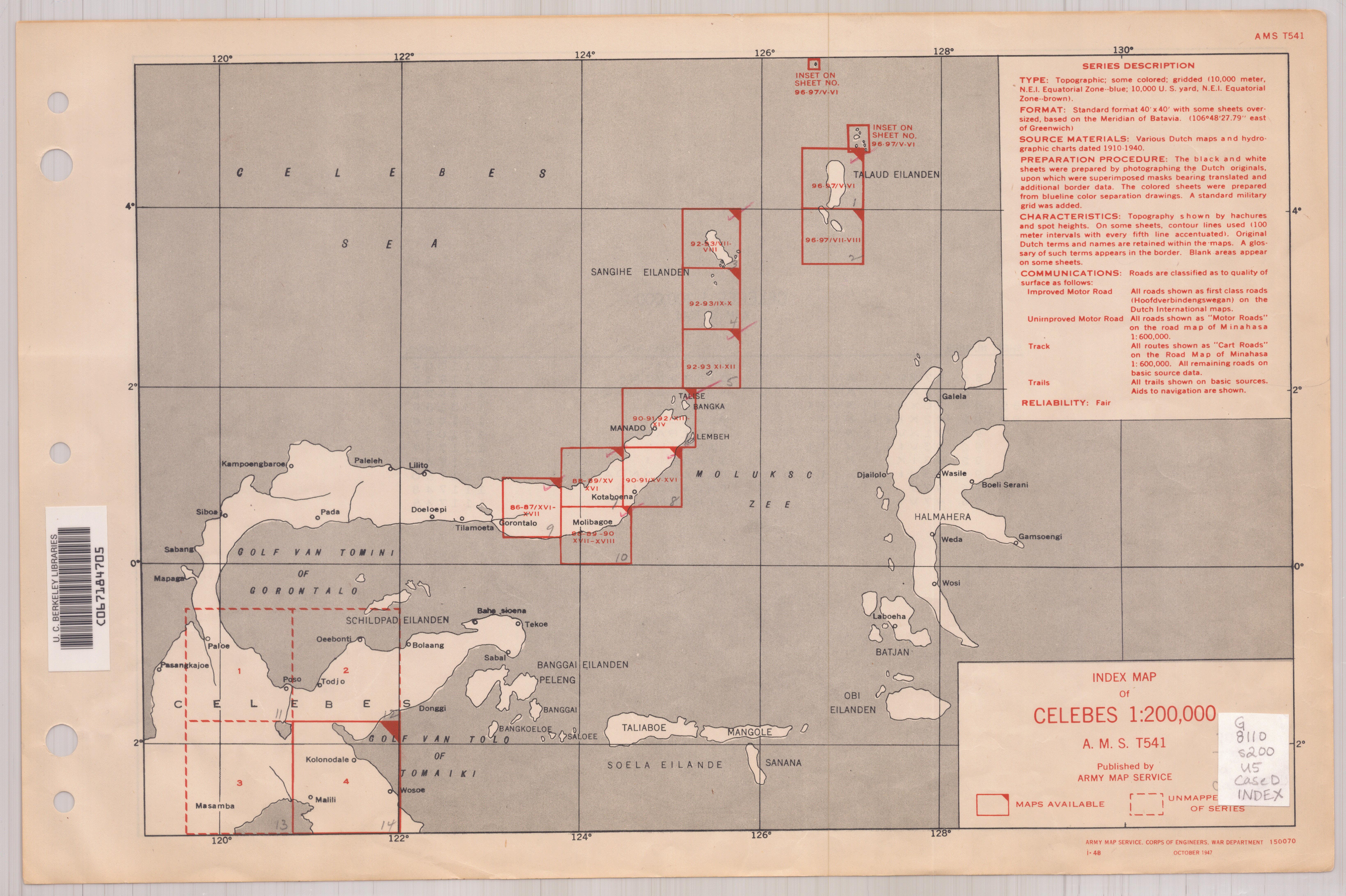
Celebes 1:200,000.
| Corporate Author: | |
|---|---|
| Format: | Map |
| Language: | English |
| Published: |
Washington, D.C. :
Army Map Service,
1942-
|
| Series: | Series (Standard map series designation system) ;
T541. |
| Subjects: | |
| Online Access: | Index map: |
| Item Description: | Relief shown by contours, form lines or hachures, and spot heights in meters. Four or five classes of roads or paths, and two types of internal boundaries are shown. Covers northeastern peninsula and islands only. Based on Dutch maps. Sheets are numbered according to the scheme used by the Topografische Dienst for the Dutch East Indies. Set includes various issues of some sheets. Longitude based on "meridian of Batavia (which is 106⁰482́7.79" E. of Greenwich)."." Military grid. Includes "Glossary." Marginal diagrams: Index to administrative divisions.--Incidence of grid letters and index to adjoining sheets. Cartographic material. |
|---|---|
| Physical Description: | maps : some color ; 37 x 40 cm. or smaller. |